

I found this interesting: The road rules here are exactly the same as in Australia, except for one small difference..
If you are turning left onto a road and another car coming the other way is turning right onto the same road, then you have to give way to them..
This actually makes sense, because you can squeeze off the side of the road to let other traffic past, but sometimes it's not always possible for the car turning right to get out of the way of traffic flow in their direction. The idea is to get the car out of the middle of the road as soon as possible. Good thinking!
Monday, November 27, 2006
Sunday, November 26, 2006
South, south, and away!
 Monday, I worked my way down to Invercargill, NZ's southern-most city. An interesting place in that it has all the amenities of a modern city, but a very low skyline, which makes it seem a little larger than it actually is. It had a bit of a sea-side town feel. Nonetheless, it was very quiet and not much was happenin
 g. There were quite a few shops that had closed down, and after about 1800hr there was noone on the streets. But, I was really only using this city as a base for my travels to Stewart Island/Rakiura,
 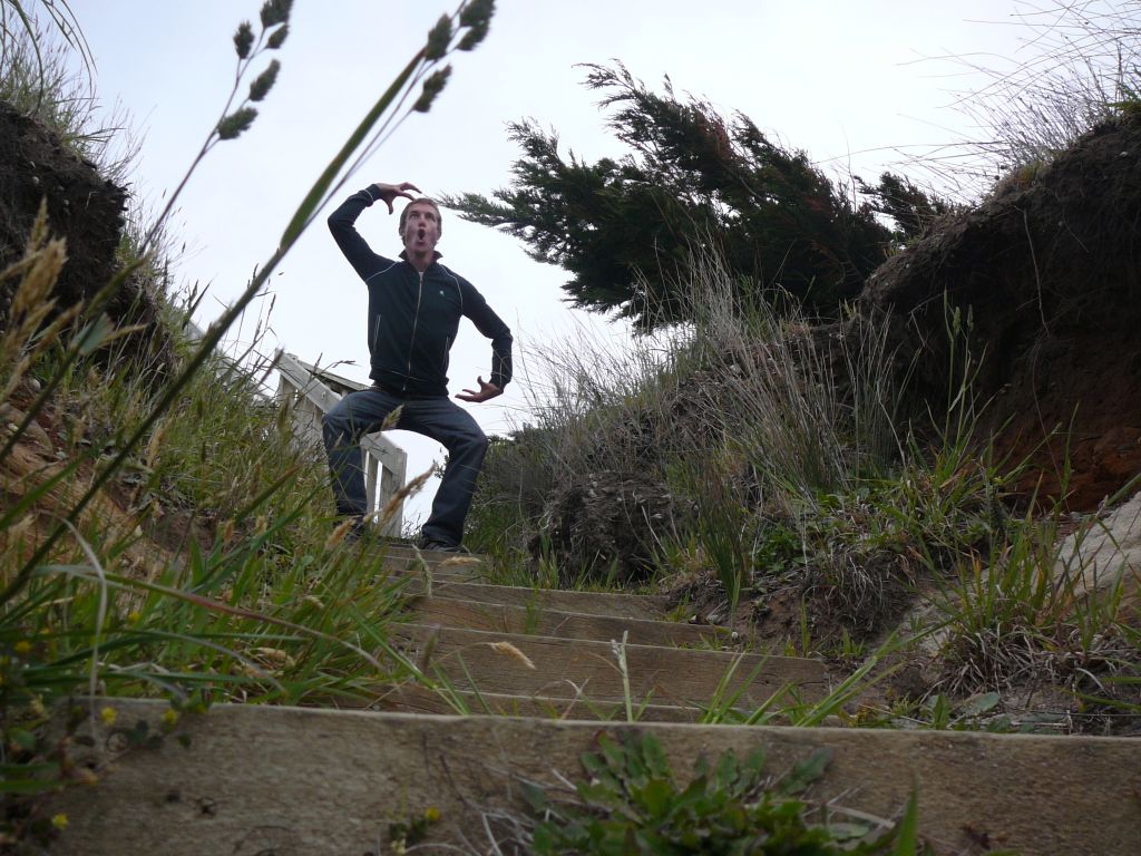 although I did manage to take some time to peruse the museum and art gallery on Tuesday.
In the morning on Wednesday, I drove south to Bluff, where the ferry to Rakiura departs
 . What a run-down town this one is.. A big port, some mussel processing plants and a small industrial area form its crux. The ferry across Foveaux Strait was rough enough that it made one lady
 sick, but certainly not as rough as it can get from what I've heard - this Strait lies right in the middle of what is called the Roaring Forties (indicating the wind speed and latitude south).
 As soon as we arrived, I made my way by water taxi across to Ulva Island - a bird sanctuary where all pests have been eliminated and some endangered species have even been re-
 introduced. Just sitting and listening to all the bird calls was so relaxing.
I'm not sure what I did that day to disrupt the environmental balance, but I started getting attacked by the
 animals there! Firstly, I came across this very out-of-place sealion along one of the tracks, at least a kilometre from the sea. She didn't look too happy and I thought she may have
  been dying; laboured breath, lack of energy, etc. She watched me taking photos for a while and then decided she didn't like how close I was, so she jumped up and roared. Man, I ran even faster than when
  that seal growled at me.. I mean if this thing wanted to it could have seriously done me some damage, especially if she wasn't feeling too happy anyway! Next on the list, on one
  of the beautiful, yellow, sandy beaches a little, seemingly harmless bird known as an Oyster Catcher flew up and tried attacking my face! Turns out I was loitering near her nest of 2 eggs. Then a
 short while later, a few other birds I was attempting to photograph decided they'd like to give me a swoop. I now have a healthy fear of anything that lives in trees, or on the ground..
The next day I went on an undersea adventure in a semi-submersible, one of only two in NZ. It was OK, but the night before there had been some strongish winds that stirred up a lot of silt from the harbour floor, and so visibility was not ideal. Saw lots of seaweed though!!!
 After a few more walks around (including one to a location known as Fern Gully - 10 points to the first one who guesses correctly what lies there) I caught the evening ferry back to Bluff, with the same rather tame weather providing a slightly bumpy ride. Turns out I couldn't live upto the promise I made in my blurb that I would make my way to Stewart Island's
 South Cape, but that is due to the fact that there is no track access out there. So sorry to all who I have disappointed..
I travelled east from Invercargill on Friday, passing through some lovely rolling countryside, to Slope Point, the most southern point of the South Island. So cold, wet and windy! Then it was off to Dunedin, geographically NZ's largest city, which is where I am now. Very very hilly! There seems to be a lot more to do here than in Christchurch though which makes for a more interesting stay. Yesterday I visited some
 museums and art galleries, bumped into Nicole again, then walked (and ran) up and down Baldwin St., the world's steepest street, which at its maximum achieves a gradient of
  1:2.86 (Yes, a lot of NZ's attractions seem to be based upon the biggest, the longest, the fastest.. Pretty much think of an adjective and they have maximised it somewhere here).
  Unfortunately, Tana had a little less success with this.. She nearly made it to the top, but practically stalled with about 10 metres to go (I think she, and the rest of the neighbourhood got choked with the amount of smoke pouring from her exhaust!).. Poor Tana..
 A little later on, Nicole and I tried to find the tallest tree in the Southern Hemisphere. With the emphasis on TRIED. After about 2.5 hours of driving around looking for the start of the track, we finally found it, but then after another a further hour of walking aimlessly around the extremely poorly signed forest we decided to give up and walk back. I think we're gonna give it another go tomorrow on our way up to Kaikoura. We also passed through Aramoana, the site of the tragedy portrayed in the movie 'Out of the Blue' that I mentioned several posts back. Couldn't really see any familiar landmarks from the movie..
This morning we took a tour through the Cadbury factory. Lovers of chocolate, prepare yourselves!
I've tried really hard to organise a flight over those rogue icebergs floating near Dunedin, but with little success as the helicopters and planes of the region are booked out with over 400 on the waiting list, unless of course I wanted to pay a small fortune.. I'm sure I'll make my way to Antarctica one day so I'm not too disappointed, but it still would have been a great experience.
 This evening I'll be venturing across to the Otago Peninsula to check out the Yellow-eyed Penguins coming ashore to their nests for the night, passing by NZ's only castle on the way. Then tomorrow it's off to Kaikoura, and onto Picton the next day ready for my ferry across to Wellington on the North Island on the 30th. It will have been just over 10 weeks that I have spent in the South Island, and it has been great fun but I'm looking forward to the change.. The next chapter of my trip! I've gone through a little more money here than I had planned and so I'm going to get a job in Wellington for a little bit to fund the remainder of my travels around the North Island. Nic (the Northerner) is up there at the moment and looking for a job also. We are planning on travelling the North together once we are both satisfied with our financial situations. See how it goes...
Photos galore! Last 2 posts.. Check it
Photos:
1. Aaaaargh!! - In the Clifden Caves
2. Road block - On the way to Invercargill
3. Feeling right at home on Monkey Island
4. I think I can see Adelaide! - End of State Highway 1, Bluff
5. Weka on an Ulva Island beach
6. Human on an Ulva Island beach (the only two buildings on the island in the background - including a Post Office!?!)
7. Superman
8. So cute, if it weren't trying to kill me!
9. Crazy bird! That Oyster-catcher
10. Watching over Halfmoon Bay
11. Baby Weka, awwwww...
12. I'd like to order a pepperoni pizza please..
13. Underwater adventure
14. Cool trees, Ulva Island
15. Battling the wind at Slope Point
16. Great view - Nugget Point
17. Almost there! - Baldwin St.
18. Not here.. Looking for the tallest tree in the Southern Hemisphere
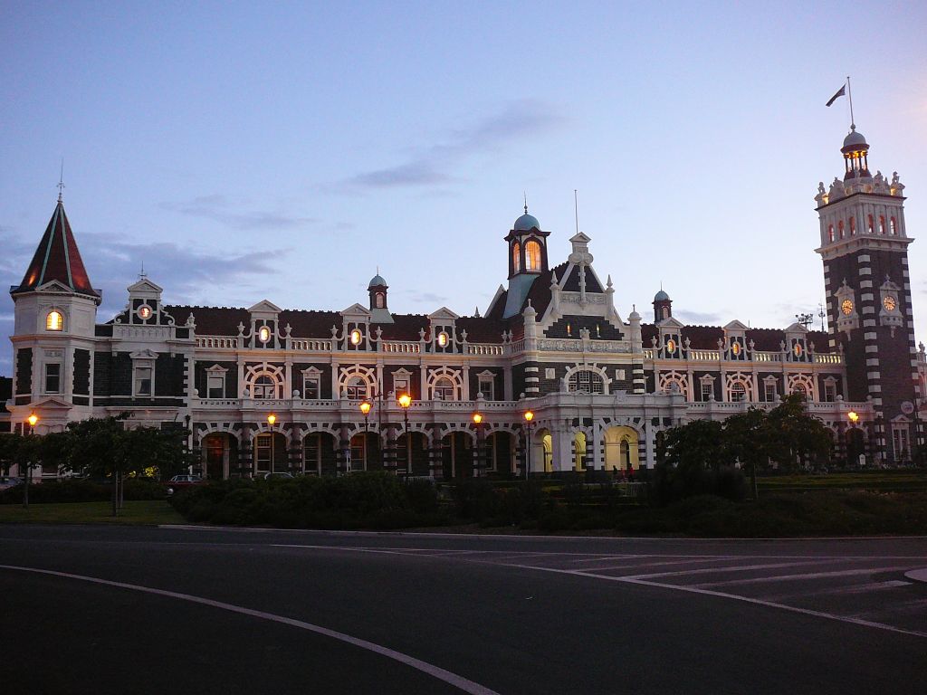
19. Cool railway station!
Friday, November 24, 2006
What an interlude!
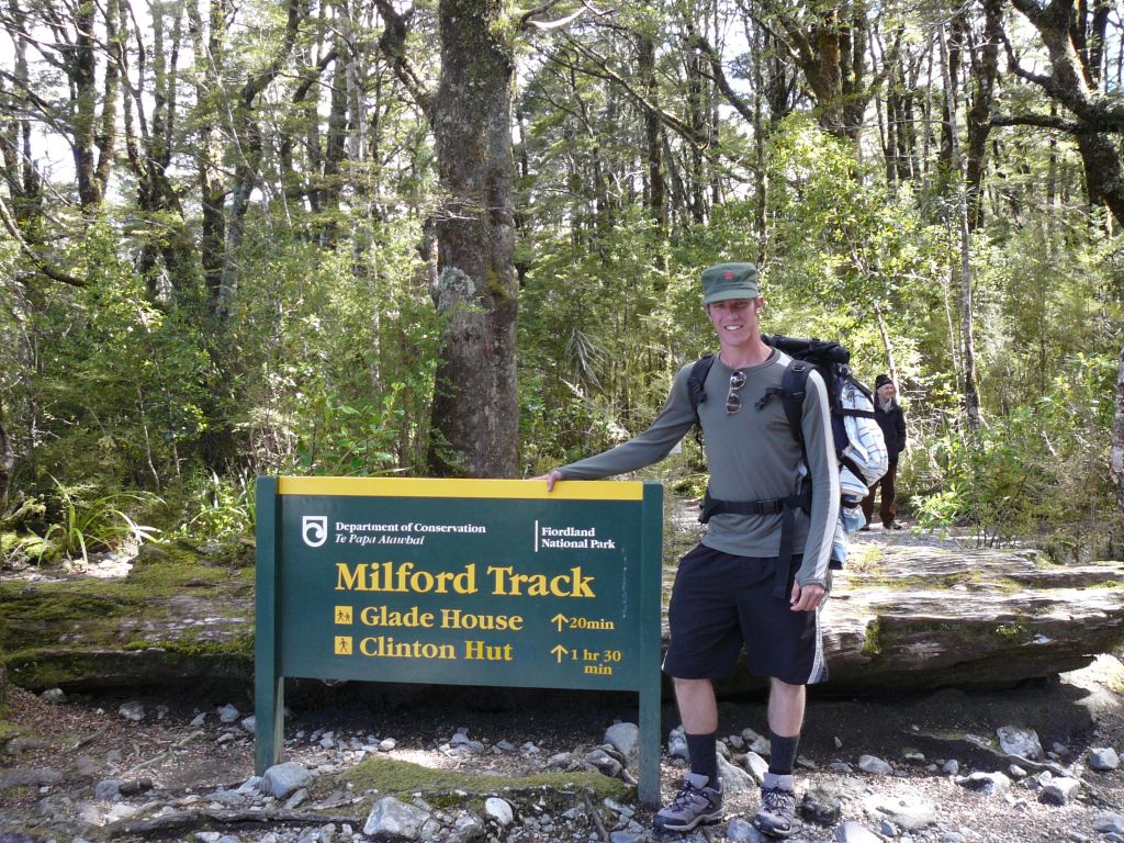
Well... What a great past week this has been! Te Anau is a beautiful little town by the lake of the same name. Monday night, I sat on the lakefront and watched the clouds pass over the sunset. Tuesday was all go with organising food, equipment, etc. for the Track and also booking some other transport and activities.  Wednesday morning, I set off with a couple of other people on our first (sunny) day on the famous Milford Track. We needed a boat to take us 2 hours up Lake Te Anau to the wharf where the track begins. This first day was actually lighter than I had hoped being only 1.5 hours walk to Clinton Hut, our first night's accommodation. By the end of the night, a total of 40 trampers were taking refuge in this huge hut. Obviously there wasn't much to do in the huts so we had to amuse ourselves, mainly playing card games.
The next day.. Rain, rain and more rain (I was told to expect it!).. We walked for about 6 hours through steep valleys riddled with raging waterfalls (more than I could count!), waded though knee-high rivers, mud, slippery rocks.. You name it. I was so glad to finally see our next stop, Mintaro Hut. The metal rack attached to the roof turned temporarily into a hanging department store with everything from boots, socks, tops, underwear and backpacks to cameras and sleeping bags all fighting to catch every last bit of warmth from the log fire below. I tell you though, the rain certainly made for a much more interesting day of tramping, thoroughly enjoyed by all (well.. most). That night.. more cards including Hearts, Nadia's game (a version of Hearts; we didnt know the name of it so just named it after the gal that showed it to us), Rummy and my favourite, Kings and Assholes (or just Asshole, or Shithead, or any other crude word you want to throw at me).
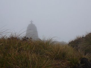 OK, the third day was the big one, the one you are supposed to have brilliant clear skies for... The rain had stopped and the skies were clear so a couple of us left just after 0700hr. We climbed to the highest point of the track, Mackinnon Pass (1073m), where on a clear day you can see down the entire length of the Clinton Canyon you had just traversed and also over the cliff's edge,
 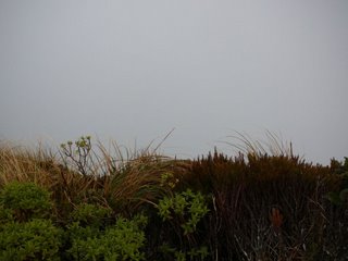 cryptically named '12 second drop'.. However, soon after we left the hut it had quickly become overcast with clouds sitting well below the treeline. And I don't just mean your ordinary, everyday, run-of-the-mill cloudy, but visibility to maybe 30 metres cloudy!!!
  That was definitely disappointing (made worse by the fact that I didn't have the time or energy to come back up the next day when the weather was in fact fine) because I would have loved to have seen that, but my disappointment quickly faded when I started my descent down the other side of the Pass where the cloud had dissipated somewhat to reveal a beautiful valley and mountainous landscape before me (again plenty of waterfalls, still fuelled by the last night's downpour).
  The rest of the way down that mountain was simply spectacular, and I can definitely see why they could claim that this walk is the 'finest in the world'. After descending around 1000m we eventually arrived at our last hut of the track, Dumpling Hut, but not before taking a detour to one of NZ's largest waterfalls, Sutherland Falls. At 580m with only 3 tiers and an average volume of 11 cubic metres/second (the maximum recorded is a whopping 142 cub.m/s!),
  the power of this waterfall is just awesome: the wind being created at the base actually sounds like an aeroplane in flight (not to mention the drenching I received from getting so close).
Saturday, the last day, and the sun was shining again. We had another 5-hour walk ahead of us. This was relatively relaxed, although the rocks were no less slippery and I nearly went arse up.. Nearly.. We made it to Sandfly Point just after 1300hr, and had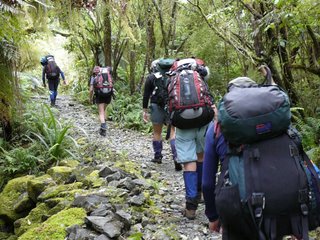 to wait there for an hour for our boat to pick us up and take us to the Milford Sound township. I now know why the place was given it's name, luckily I was prepared with the insect repellant this time though. Apparently there used to be a jail around there (they probably
 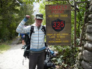 used the sandflies as a torture device), but we couldn't find any remnants of it.
It was also interesting to see the difference in quality of accomodation provided for the independent trampers (like myself) and the guided groups.. I guess that's to be expected though since they are paying around $1800 each for their 4-day experience! For that, they get their backpacks helicoptered between huts, refreshments, breakfast, dinner, lunch all cooked for them, beers, hot showers, etc. What a life hey? I almost felt sorry for them that they had to walk in the rain... Even more interesting was the fact that there actually was a bit of anonymity displayed between the two 'classes' whenever our paths crossed. Some inherent form of tribal allegiance...
 When we returned to Milford Sound, I said goodbye to the great people I'd been hanging out with those past days, and then caught a cruise on the actual sound (which is in fact technically a fiord - a valley carved out by glacial movement, as opposed to a river valley back-filled by the sea). The sheer might of these mountains rising out of the sea.. Amazing. Although I've heard it's even better when it's raining as the waterfalls are out in force, but I think I've seen enough waterfalls to last me a lifetime now..
  On the way back to Te Anau, we passed through the 1.2km Homer Tunnel. This tunnel, which slopes downward with a gradient of around 1:10 towards the sound, was dug through a granite mountain known as the
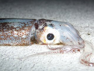 Homer Saddle and the walls to this day remain unlined granite! A slightly eerie experience.
The next day, I drove down to Manapouri, just south of Te Anau, and hopped on another boat. This time, I was being taken to Doubtful Sound (again, another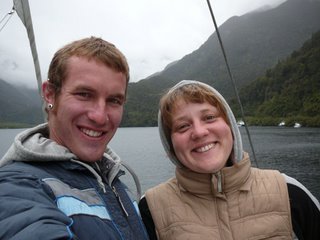 fiord) for an overnight cruise. Not only was the scenery fantastic, but we got to go kayaking, wildlife watching, and had a beautiful buffet dinner and breakfast with the lot!
 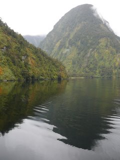 Mmmmmm! I especially enjoyed this after having just come off the Milford Track and eating tiny servings of packet pasta each night. I met a German gal by the name of Nicole here, she was great to speak with and we did so for most of the night and the next day. I was up until just after midnight watching the stars and clouds against the magnificent forest-covered mountains, then up at 0500hr to watch the sunrise (even though it was cloudy and no sun was
  actually seen) against the same stunning backdrop. At one point on our way back to shore, the captain shut off the engines, the generators, everything so that we could all sit in silence on the deck and just take in the sights and sounds.. Magical.
Just breaking this post up, but here's the first part. Much more to come (including pictures)...
Photos:
1. In the beginning... (1st day)
2. Just spectacular, VERY wet! (2nd day)
3. The Mackinnon's memorial on top of Mackinnon Pass (3rd day)
4. Looking over 12-second drop. Doesn't look too bad.. Does it?
5. Over the pass, we were hit with these beautiful views
6. Passing by one of the many rivers, I couldn't help but capture this
7. Sutherland Falls. Huge!
8. A bunch of Kiwis on the track - great guys (4th day)
9. Phew!
10. Milford Sound (see the boats?)
11. "My heart will go on" - Doubtful Sound around 0600hr
12. Found this stowaway on the deck after we had anchored for the night
13. Nicole and I
14. So colourful, so peaceful
15. Silence.. As the engines were switched off
 Wednesday morning, I set off with a couple of other people on our first (sunny) day on the famous Milford Track. We needed a boat to take us 2 hours up Lake Te Anau to the wharf where the track begins. This first day was actually lighter than I had hoped being only 1.5 hours walk to Clinton Hut, our first night's accommodation. By the end of the night, a total of 40 trampers were taking refuge in this huge hut. Obviously there wasn't much to do in the huts so we had to amuse ourselves, mainly playing card games.
The next day..
 Rain, rain and more rain (I was told to expect it!).. We walked for about 6 hours through steep valleys riddled with raging waterfalls (more than I could count!), waded though knee-high rivers, mud, slippery rocks.. You name it. I was so glad to finally see our next stop, Mintaro Hut. The metal rack attached to the roof turned temporarily into a hanging department store with everything from boots, socks, tops, underwear and backpacks to cameras and sleeping bags all fighting to catch every last bit of warmth from the log fire below. I tell you though, the rain certainly made for a much more interesting day of tramping, thoroughly enjoyed by all (well.. most). That night.. more cards including Hearts, Nadia's game (a version of Hearts; we didnt know the name of it so just named it after the gal that showed it to us), Rummy and my favourite, Kings and Assholes (or just Asshole, or Shithead, or any other crude word you want to throw at me).
 OK, the third day was the big one, the one you are supposed to have brilliant clear skies for... The rain had stopped and the skies were clear so a couple of us left just after 0700hr. We climbed to the highest point of the track, Mackinnon Pass (1073m), where on a clear day you can see down the entire length of the Clinton Canyon you had just traversed and also over the cliff's edge,
  cryptically named '12 second drop'.. However, soon after we left the hut it had quickly become overcast with clouds sitting well below the treeline. And I don't just mean your ordinary, everyday, run-of-the-mill cloudy, but visibility to maybe 30 metres cloudy!!!
  That was definitely disappointing (made worse by the fact that I didn't have the time or energy to come back up the next day when the weather was in fact fine) because I would have loved to have seen that, but my disappointment quickly faded when I started my descent down the other side of the Pass where the cloud had dissipated somewhat to reveal a beautiful valley and mountainous landscape before me (again plenty of waterfalls, still fuelled by the last night's downpour).
  The rest of the way down that mountain was simply spectacular, and I can definitely see why they could claim that this walk is the 'finest in the world'. After descending around 1000m we eventually arrived at our last hut of the track, Dumpling Hut, but not before taking a detour to one of NZ's largest waterfalls, Sutherland Falls. At 580m with only 3 tiers and an average volume of 11 cubic metres/second (the maximum recorded is a whopping 142 cub.m/s!),
 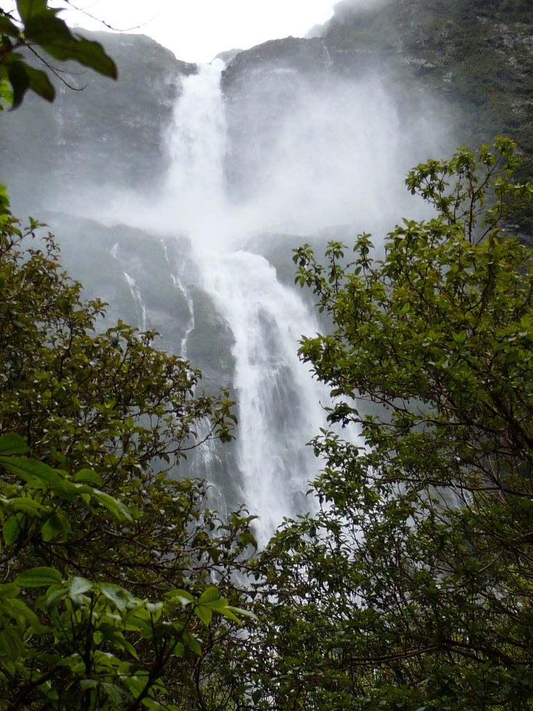 the power of this waterfall is just awesome: the wind being created at the base actually sounds like an aeroplane in flight (not to mention the drenching I received from getting so close).
Saturday, the last day, and the sun was shining again. We had another 5-hour walk ahead of us. This was relatively relaxed, although the rocks were no less slippery and I nearly went arse up.. Nearly.. We made it to Sandfly Point just after 1300hr, and had
 to wait there for an hour for our boat to pick us up and take us to the Milford Sound township. I now know why the place was given it's name, luckily I was prepared with the insect repellant this time though. Apparently there used to be a jail around there (they probably
  used the sandflies as a torture device), but we couldn't find any remnants of it.
It was also interesting to see the difference in quality of accomodation provided for the independent trampers (like myself) and the guided groups.. I guess that's to be expected though since they are paying around $1800 each for their 4-day experience! For that, they get their backpacks helicoptered between huts, refreshments, breakfast, dinner, lunch all cooked for them, beers, hot showers, etc. What a life hey? I almost felt sorry for them that they had to walk in the rain... Even more interesting was the fact that there actually was a bit of anonymity displayed between the two 'classes' whenever our paths crossed. Some inherent form of tribal allegiance...
 When we returned to Milford Sound, I said goodbye to the great people I'd been hanging out with those past days, and then caught a cruise on the actual sound (which is in fact technically a fiord - a valley carved out by glacial movement, as opposed to a river valley back-filled by the sea). The sheer might of these mountains rising out of the sea.. Amazing. Although I've heard it's even better when it's raining as the waterfalls are out in force, but I think I've seen enough waterfalls to last me a lifetime now..
 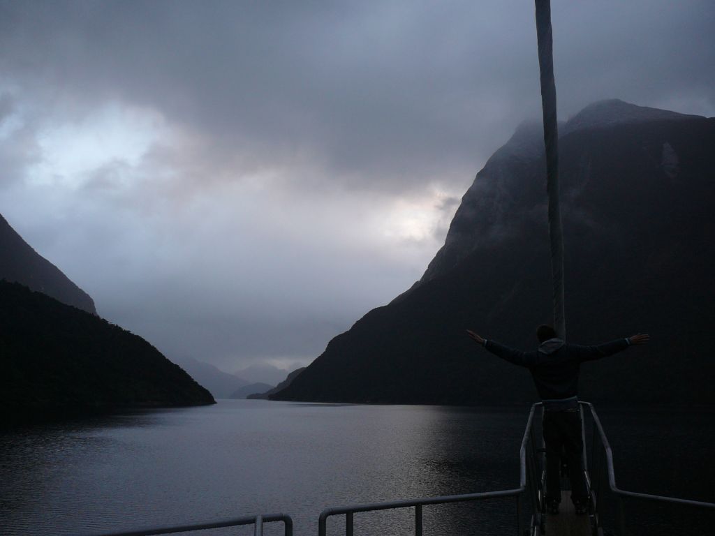 On the way back to Te Anau, we passed through the 1.2km Homer Tunnel. This tunnel, which slopes downward with a gradient of around 1:10 towards the sound, was dug through a granite mountain known as the
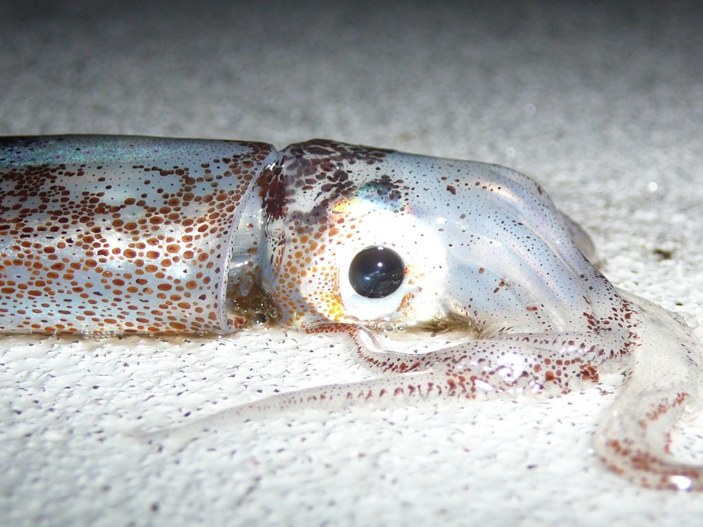 Homer Saddle and the walls to this day remain unlined granite! A slightly eerie experience.
The next day, I drove down to Manapouri, just south of Te Anau, and hopped on another boat. This time, I was being taken to Doubtful Sound (again, another
 fiord) for an overnight cruise. Not only was the scenery fantastic, but we got to go kayaking, wildlife watching, and had a beautiful buffet dinner and breakfast with the lot!
  Mmmmmm! I especially enjoyed this after having just come off the Milford Track and eating tiny servings of packet pasta each night. I met a German gal by the name of Nicole here, she was great to speak with and we did so for most of the night and the next day. I was up until just after midnight watching the stars and clouds against the magnificent forest-covered mountains, then up at 0500hr to watch the sunrise (even though it was cloudy and no sun was
  actually seen) against the same stunning backdrop. At one point on our way back to shore, the captain shut off the engines, the generators, everything so that we could all sit in silence on the deck and just take in the sights and sounds.. Magical.
Just breaking this post up, but here's the first part. Much more to come (including pictures)...
Photos:
1. In the beginning... (1st day)
2. Just spectacular, VERY wet! (2nd day)
3. The Mackinnon's memorial on top of Mackinnon Pass (3rd day)
4. Looking over 12-second drop. Doesn't look too bad.. Does it?
5. Over the pass, we were hit with these beautiful views
6. Passing by one of the many rivers, I couldn't help but capture this
7. Sutherland Falls. Huge!
8. A bunch of Kiwis on the track - great guys (4th day)
9. Phew!
10. Milford Sound (see the boats?)
11. "My heart will go on" - Doubtful Sound around 0600hr
12. Found this stowaway on the deck after we had anchored for the night
13. Nicole and I
14. So colourful, so peaceful
15. Silence.. As the engines were switched off
Monday, November 13, 2006
Back to Nature
To give you an update on my journal.. Nothing! Almost a week has passed now and I have written it off as a stupid mistake on my behalf. I will buy a new one the next couple of days and start from now..
 One thing I forgot to mention was on Wednesday I stopped to take a look at the Pupu Springs on my way to the Farewell Spit. They are NZ's largest natural spring which boast the clearest freshwater in the world. Beautiful!
 Thursday I did finally get to Abel Tasman, but not before taking a detour to Wainui Waterfall, passing over a great little swingbridge and nearly killing myself when I slipped on the
  wet, mossy rocks near the actual waterfall. Fun, fun.. The 6 hour tramp in Abel Tasman was tiresome, but very visually and personally rewarding, with magnificent yellow-orange sandy beaches
  backing onto lush rainforest and great views over the entire park. I even saw a seal close-up at Separation Point, but I think I got a little close when it started growling at me.. I've never
  backtracked so quick in my life!
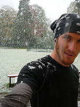
That night I made my way down to St Arnauds in the Nelson Lakes National Park, arriving just before 2200hr. Big day, a total of about 8 hours solid walking.. In the morning I was up early to go for another brisk walk in this park. Two hours later I was standing on top of Mt. Robert (about 1200m above sea level) in what becomes a ski field in the winter, looking
  over the brilliant blue Lake Rotoiti. It even started snowing while I was up there, and I was only wearing shorts! Brrr.. But again very visually and personally rewarding!
Later on, I took the scenic route down to Arthur's Pass where the weather was, exactly as last time, very wet and cold. Again the wood-fire was raging and I met a great British guy by the name of Scott, who seems to be at exactly the same stage of his trip (and life in general) as myself. Was again a great chilled environment, lovely to relax in.
 In the morning, I shot off at about 0830hr towards Christchurch as a stop off on my way to Mt. Cook, where I hoped to do some tramping, as the last time I was there you couldn't even see the mountains due to rain and low-lying cloud.
  On the way, I passed by Peel Forest, which is one of the most important forest scenic reserves in NZ. There are trees over 1000 years old here, one of which is a Totara tree with a diameter of nearly 3 metres!
The weather was pretty much the same as last time in Mt. Cook when I arrived (even worse with a thunder storm passing over), but the forecast for Sunday was supposed to be much better. And that it was. I awoke in the morning and lo and behold.. clear skies! I set out at
  0730hr, with a great German guy by the name of Timo, to the Hooker Valley which the mighty Mt. Cook totally dominates. As we entered the valley (after crossing two more swingbridges),
  the winds picked up and reached nearly gale force by the time we arrived at the end of the track at Hooker Lake. We had to hide in a crevice under a large boulder as shelter from the wind and hard-hitting rain/ice particles flying through the air. In the lake we found several small icebergs that had recently broken off from the glacier which feeds the lake. Stunning! And the views of Mt. Cook, although partially obstructed by cloud, were unbeatable! The cloud peeling away from the peak looked amazing!
Then it was back to Qtown, which is where I am at the moment.. No, not to stay, but as a stop on the way to Te Anau, leaving in a few hours. My first trip south into Fiordland, very exciting! I have a few loose ends to tie up here, such as getting Tana serviced and posting more fliers in hostels about my Magic Bus Ticket.
On Wednesday, my first proper tramping session begins.. The Milford Track.. It has been claimed that this is the finest walk in the world! And I am so excited for this one as it is one of the few things I really wanted to do here in Aotearoa. Four days, three nights, and a whole lot of waterfalls! Starting at the northern tip of Lake Te Anau, myself and several others work our way though the spectacular Fiordland National Park, 53.5km to a place called Sandfly Point (I wonder what's there?!) in Milford Sound. I've been told to expect at least one day of rain as this area receives 14 days of rain out of the 30 in November. Let's hope the Gods are feeling generous! I'm expecting to be out of mobile range for these 4 days, but who knows, maybe they've decided to put some towers around the park? I'll check that out when I get to Te Anau.
Wish me luck, and some good weather! Oh and Lee, as you suggested, I'll try not kill myself on the track!
 One thing I forgot to mention was on Wednesday I stopped to take a look at the Pupu Springs on my way to the Farewell Spit. They are NZ's largest natural spring which boast the clearest freshwater in the world. Beautiful!
 Thursday I did finally get to Abel Tasman, but not before taking a detour to Wainui Waterfall, passing over a great little swingbridge and nearly killing myself when I slipped on the
  wet, mossy rocks near the actual waterfall. Fun, fun.. The 6 hour tramp in Abel Tasman was tiresome, but very visually and personally rewarding, with magnificent yellow-orange sandy beaches
 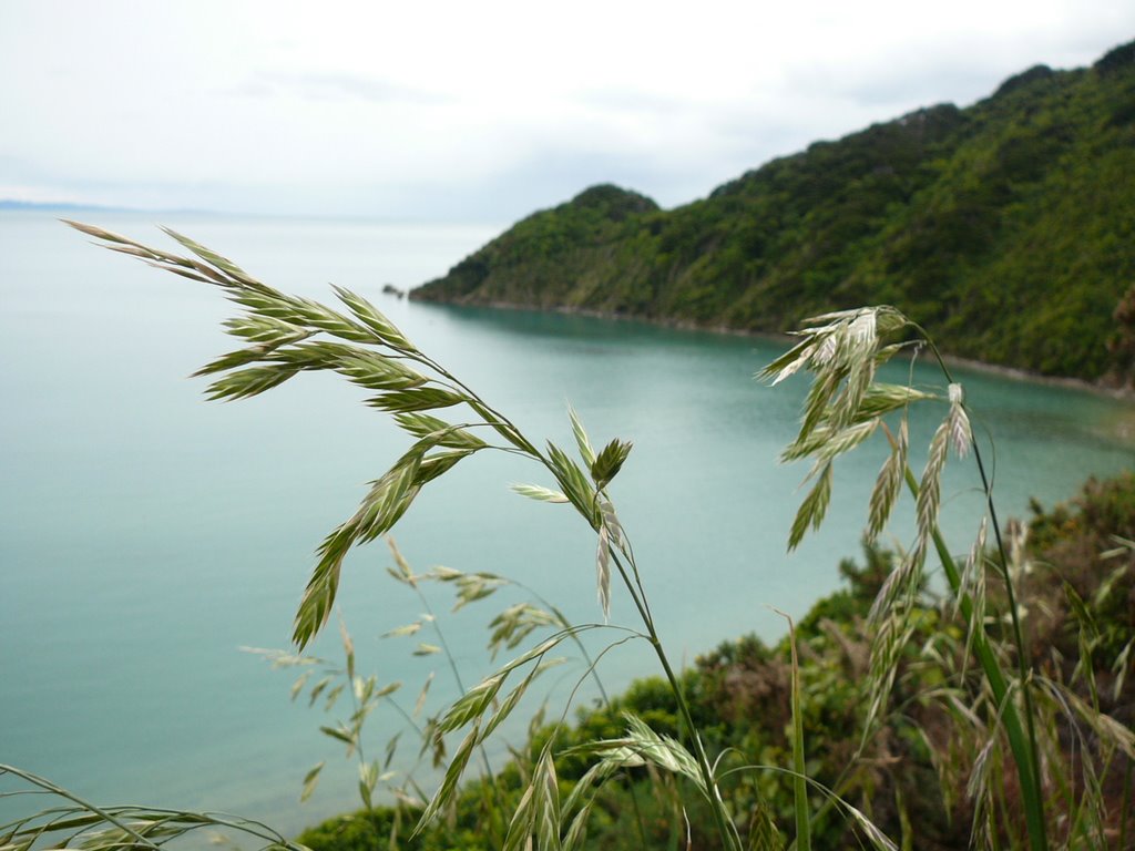 backing onto lush rainforest and great views over the entire park. I even saw a seal close-up at Separation Point, but I think I got a little close when it started growling at me.. I've never
  backtracked so quick in my life!
That night I made my way down to St Arnauds in the Nelson Lakes National Park, arriving just before 2200hr. Big day, a total of about 8 hours solid walking.. In
 the morning I was up early to go for another brisk walk in this park. Two hours later I was standing on top of Mt. Robert (about 1200m above sea level) in what becomes a ski field in the winter, looking
  over the brilliant blue Lake Rotoiti. It even started snowing while I was up there, and I was only wearing shorts! Brrr.. But again very visually and personally rewarding!
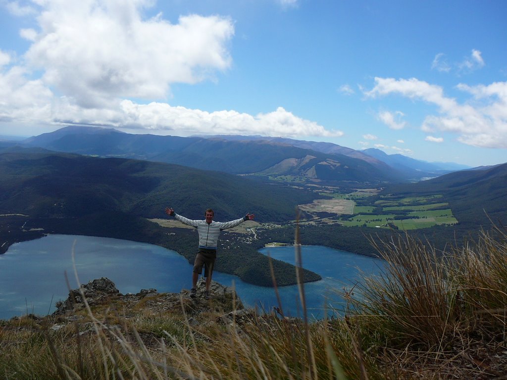
Later on, I took the scenic route down to Arthur's Pass where the weather was, exactly as last time, very wet and cold. Again the wood-fire was raging and I met a great British guy by
 the name of Scott, who seems to be at exactly the same stage of his trip (and life in general) as myself. Was again a great chilled environment, lovely to relax in.
 In the morning, I shot off at about 0830hr towards Christchurch as a stop off on my way to Mt. Cook, where I hoped to do some tramping, as the last time I was there you couldn't even see the mountains due to rain and low-lying cloud.
 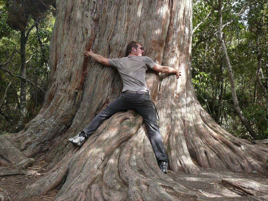 On the way, I passed by Peel Forest, which is one of the most important forest scenic reserves in NZ. There are trees over 1000 years old here, one of which is a Totara tree with a diameter of nearly 3 metres!
The weather was
 pretty much the same as last time in Mt. Cook when I arrived (even worse with a thunder storm passing over), but the forecast for Sunday was supposed to be much better. And that it was. I awoke in the morning and lo and behold.. clear skies! I set out at
  0730hr, with a great German guy by the name of Timo, to the Hooker Valley which the mighty Mt. Cook totally dominates. As we entered the valley (after crossing two more swingbridges),
  the winds picked up and reached nearly gale force by the time we arrived at the end of the track at Hooker Lake. We had to hide in a crevice under a large boulder as shelter from the wind and hard-hitting rain/ice particles flying through the air. In the lake we found several small icebergs that had recently broken off from the glacier which feeds the lake. Stunning! And the views of Mt. Cook, although partially obstructed by cloud, were unbeatable! The cloud peeling away from the peak looked amazing!
Then it was back to Qtown, which is where I am at the moment.. No, not to stay, but as a stop on the way to Te Anau, leaving in a few hours. My first trip south into Fiordland, very exciting! I have a few loose ends to tie up here, such as getting Tana serviced and posting more fliers in hostels about my Magic Bus Ticket.
On Wednesday, my first proper tramping session begins.. The Milford Track.. It has been claimed that this is the finest walk in the world! And I am so excited for this one as it is one of the few things I really wanted to do here in Aotearoa. Four days, three nights, and a whole lot of waterfalls! Starting at the northern tip of Lake Te Anau, myself and several others work our way though the spectacular Fiordland National Park, 53.5km to a place called Sandfly Point (I wonder what's there?!) in Milford Sound. I've been told to expect at least one day of rain as this area receives 14 days of rain out of the 30 in November. Let's hope the Gods are feeling generous! I'm expecting to be out of mobile range for these 4 days, but who knows, maybe they've decided to put some towers around the park? I'll check that out when I get to Te Anau.
Wish me luck, and some good weather! Oh and Lee, as you suggested, I'll try not kill myself on the track!
I've added a couple of photos to my previous blog aswell.
Photos:
1. Pupu Springs, this picture doesn't do the place any justice, but you get the idea..
2. Watch your step!
3. The Wainui Waterfall (this is just before I slipped!)
4. Serenity in the Abel Tasman
5. Sunbaking anyone?
6. "I made it!" to the top - Abel Tasman
7. Looking over the valleys of Nelson Lakes National Park
8. "I made it!" to the top of Mt. Robert, that is Lake Rotoiti
9. Huh?
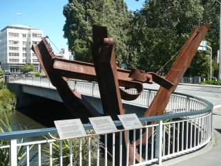
10. Sculpture made using metal beams salvaged from the WTC. Donated to the City of Christchurch in memory of the NZ firefighters who lost their lives in the September 11 attacks
11. Damn hippies!
12. Some interesting limestone formations I came across on the road from Arthur's Pass - Kura Tawhiti Conservation Area
13. Timo and I enjoying 'second breakfast' while sheltering from the harsh winds - Hooker Lake, Mt. Cook
14. Mt. Cook in all its glory. See what I mean about the cloud eminating from its peak?
Wednesday, November 08, 2006
Stupid, stupid!!
After writing my last blog entry on Monday night, I inadvertently left my backpack unzipped as I exited the internet cafe. It wasn't until the morning that I realised my journal (the one I had just brought up-to-date a few days earlier) was missing. I searched frantically thru my room in the hostel and then ran down the street, retracing my steps from last night. Unfortunately, my journal was nowhere to be seen.. After sticking up posters around town, giving my number to the Police Lost and Found, putting an ad in the newspaper, sending a message to all hostels in Nelson, etc. all I have been able to determine is that someone saw an elderly couple pick it up that night. I have now left Nelson, but have left my number with Alan from Trampers Rest in case he hears anything. I still hold some hope of having it returned, but 2 days on it's not looking good.. In that journal was everything from my last 7 weeks of travelling, the people I have met, the places I have been, etc.. Not to mention a card from Nic. I guess I'll just have to start afresh from now if it doesn't turn up.
I didn't get a chance to do Abel Tasman on Tuesday due to bad weather and the fact that I was putting all of my energy into trying to locate my journal. Today, I worked my way west from Nelson, up to a place called Takaka on the northern end of Abel Tasman. Later on this afternoon, I drove to the Farewell Spit, a 26km long sand formation extending from the shoreline into the sea. Most of this unusual scythe-shaped geological formation is a renowned bird sanctuary - the summer home of thousands of migratory waders from the Arctic tundra - limiting access to guided groups only.
  I attempted to walk the publicly accessable track around the base of the Spit, but torrential rain forced me to turn back. Tomorrow, the weather is looking a little better, so I will be doing the walk in Abel Tasman from this northern end (apparently it's a nicer walk anyway).
No pictures as of yet (this computer is ancient)...
Photos:
1. Looking quite wet at Farewell Spit
2. Hmmmm, just in case..
I didn't get a chance to do Abel Tasman on Tuesday due to bad weather and the fact that I was putting all of my energy into trying to locate my journal. Today, I worked my way west from Nelson, up to a place called Takaka on the northern end of Abel Tasman.
 Later on this afternoon, I drove to the Farewell Spit, a 26km long sand formation extending from the shoreline into the sea. Most of this unusual scythe-shaped geological formation is a renowned bird sanctuary - the summer home of thousands of migratory waders from the Arctic tundra - limiting access to guided groups only.
  I attempted to walk the publicly accessable track around the base of the Spit, but torrential rain forced me to turn back. Tomorrow, the weather is looking a little better, so I will be doing the walk in Abel Tasman from this northern end (apparently it's a nicer walk anyway).
No pictures as of yet (this computer is ancient)...
Photos:
1. Looking quite wet at Farewell Spit
2. Hmmmm, just in case..
Subscribe to:
Comments (Atom)